Meishu
Drone Based Rescue Aid System to find the stable apex and communicate it to people, streamlining the flow of people post ruckus
Created on 31st March 2019
•
Meishu
Drone Based Rescue Aid System to find the stable apex and communicate it to people, streamlining the flow of people post ruckus
Challenges we ran into
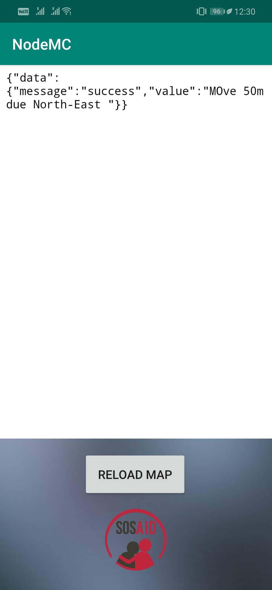
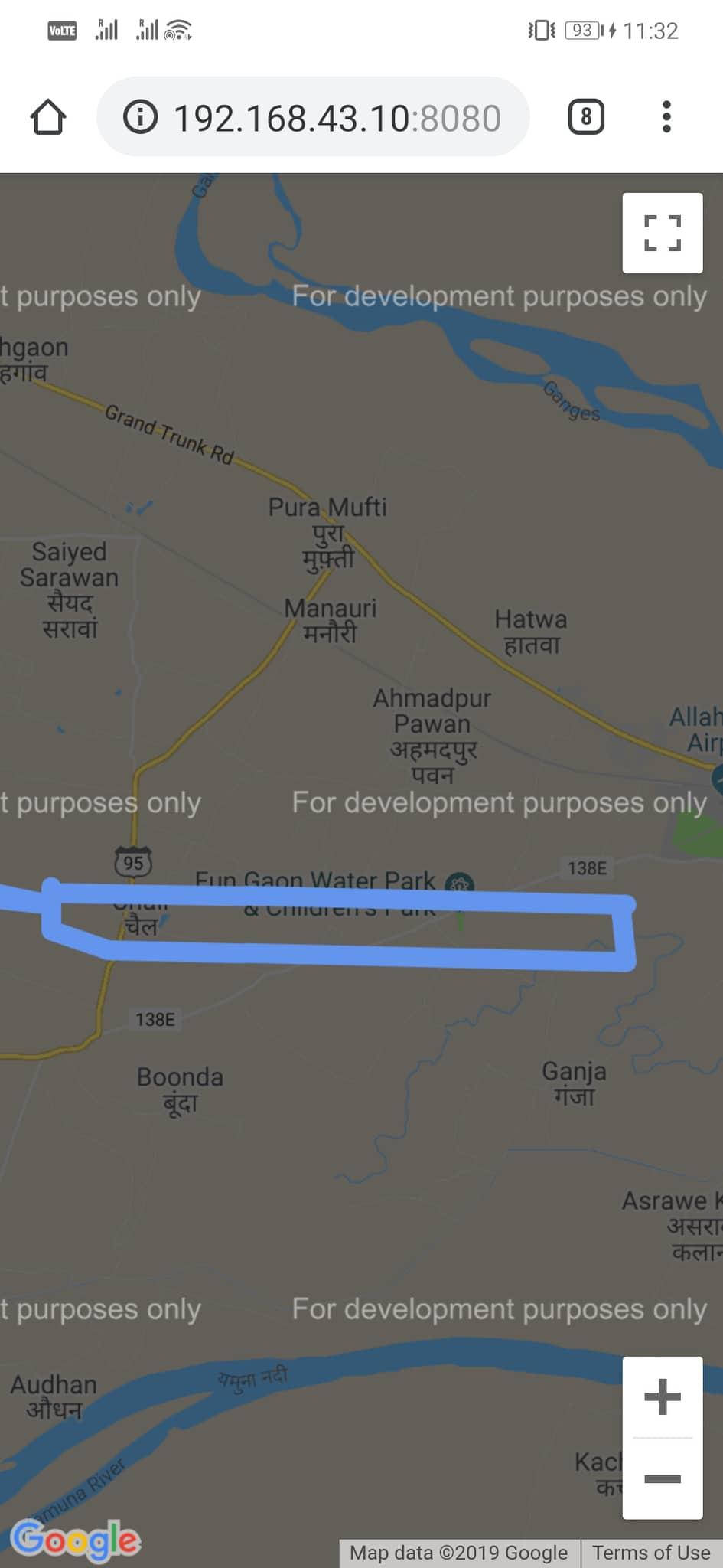
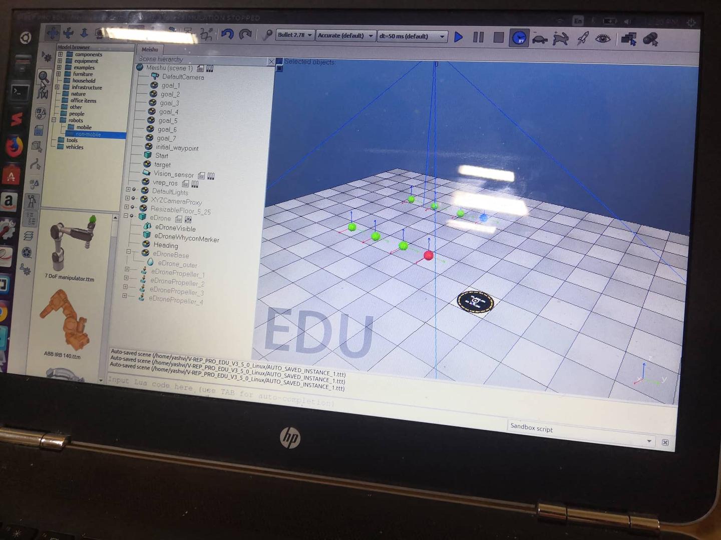
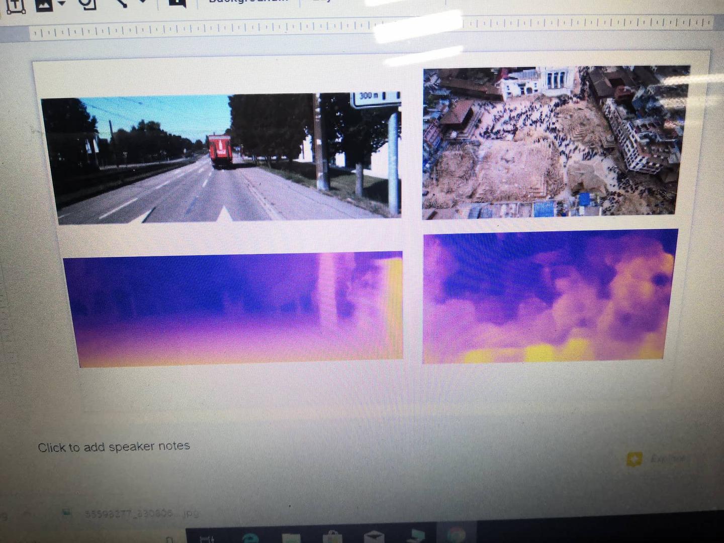
Disaster refers to a widespread severe disruption of the social, economic and environmental resources of a community which affects every sphere of life equally, be it a rich man or a poor man, or even animals. The major causes which causes distress once a disaster has occurred is lack of information and loss of information conveying capability in such cases. In the proposed idea, we aid the rescuing process multifold. In cases of floods and other water related calamities, it is the safest practice to find the highest ground possible to stay away from water and prevent you from drowning. In cases of calamities like earthquakes which scatters the mass and makes it harder and much more expensive for the rescuing teams to find individuals who are stuck for appropriate directions, a common and often higher planar ground for easy identification is desirable. Hence, we propose a solution which uses drones to 3D map the whole disaster stricken area, map the points according to their height, and deliver this, along with any other crucial information to the user smartphones using a developed app which offers a fast and reliable point-to-point communication protocol to get connected to the drones already in the process of 3D mapping, and receives crucial information to the user. Further, the communication is made two way where a user, along with their localized position in the 3D map, could give a distress message for stuck-immobile people using the connection itself by pushing a simple button. This solution aims to solve the problem of gathering valuable data in a precise and efficient way using drones and also the problem of lack of communication link, by making a short ranged P2P communication link with devices that is possessed by a very large portion of the population, i.e., mobile to drone communication, all while making the . The saved information are then relayed to the rescue team to pinpoint the rescue operation and localized map the whole area.