GeoARgraphy
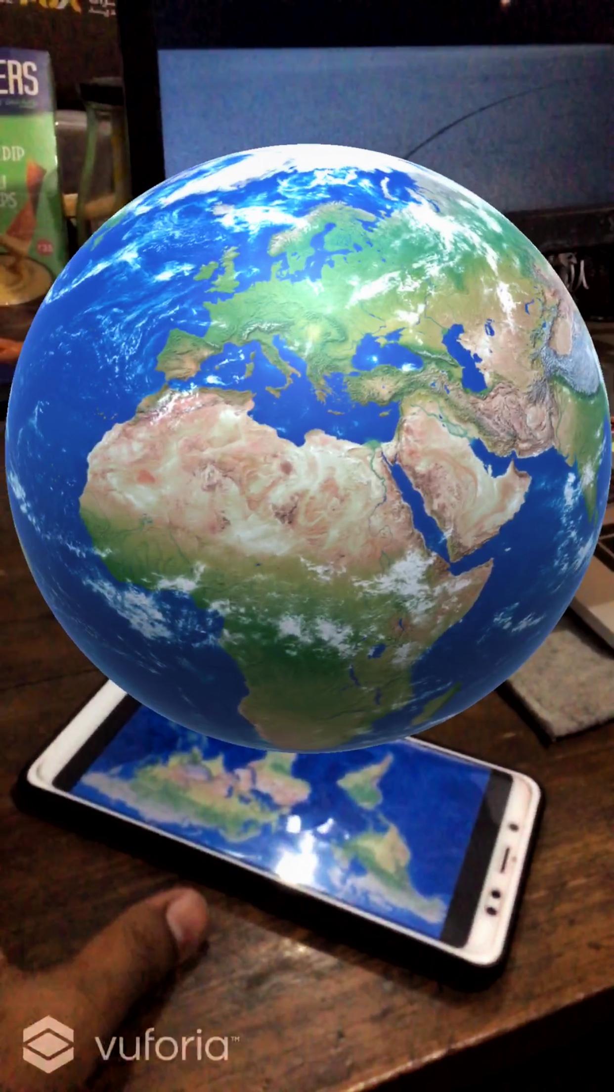
An augmented reality geography guessing game made in Unity.
Created on 31st March 2019
•
GeoARgraphy
An augmented reality geography guessing game made in Unity.
The problem GeoARgraphy solves
"Gamification is 75% psychology and 25% technology."
-Gabe Zichermann
The problem with the current education system is that students have a lot of books to read and reading them is very slow and a boring process. Moreover, research shows that we only retail 10% of the things we read. On the other hand, things we see are retained upto 30%. This is where e-learning comes in. By making the education visual and interactive, students can retain upto 5 times more. This is termed as Gamification.
It is the process of applying gaming principles or design elements to an existing concept or product. The technique of gamification enhances user engagement. This is one of the advantages of gamification which is extremely useful for e-learning.
Many people overestimate their knowledge of geography. This app helps not only students but also anyone who wants to learn while having fun.
Challenges we ran into
Initially we thought of getting the latitudes and longitudes from the 3D sphere using mouse clicks. However mapping Spherical Coordinates from 2D Cartesian Coordinates was too big of a task. Plus the coordinates on the sphere would not stay constant when we would be moving all around the globe. We researched staying awake the whole night but figured out that the task was not feasible while moving around the globe. Hence we had to choose a different approach which we started after the mid evaluation.
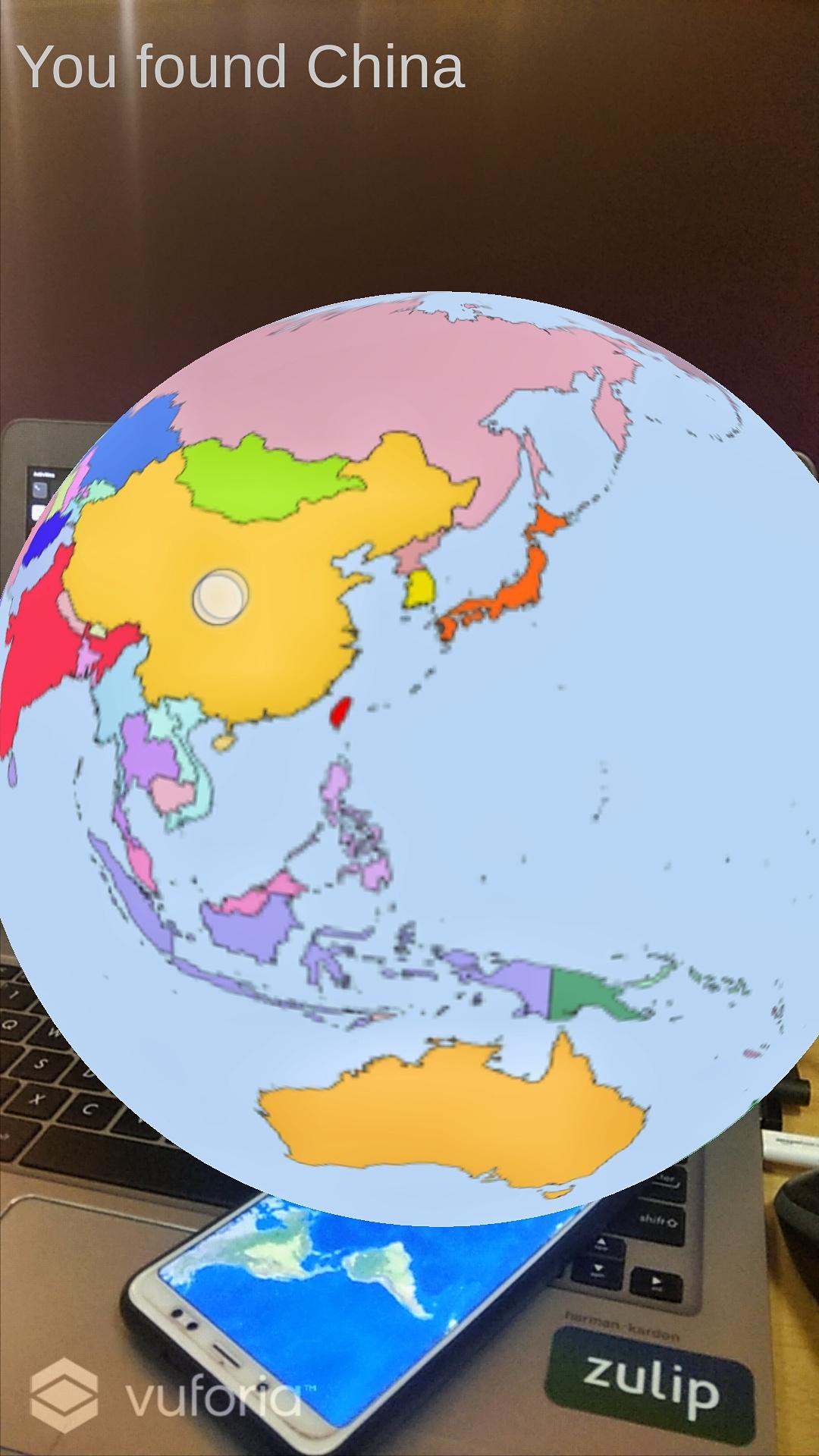
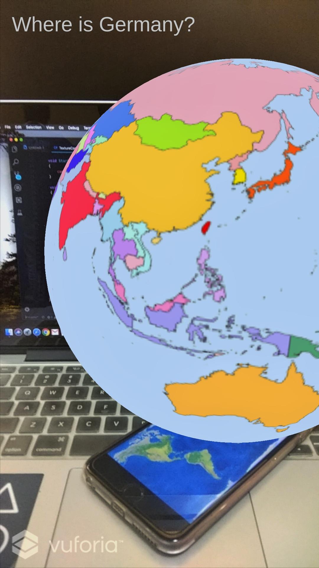
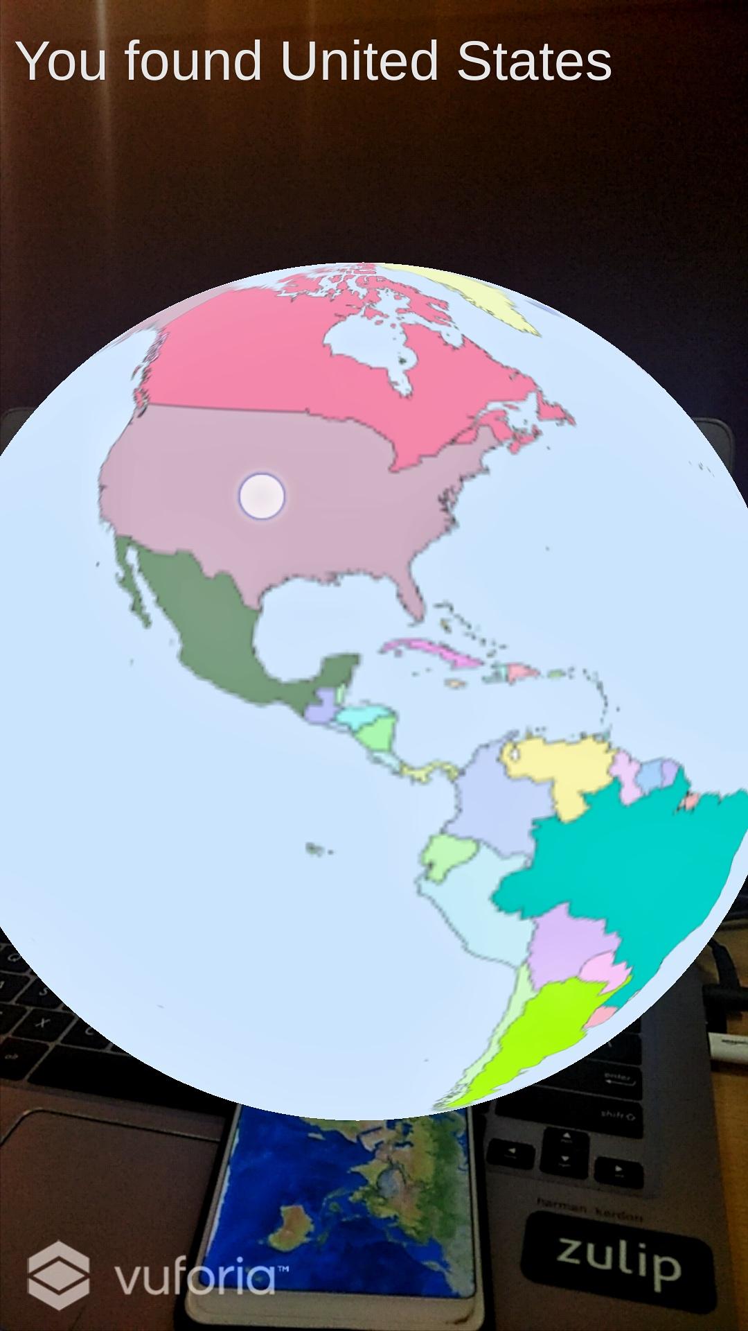
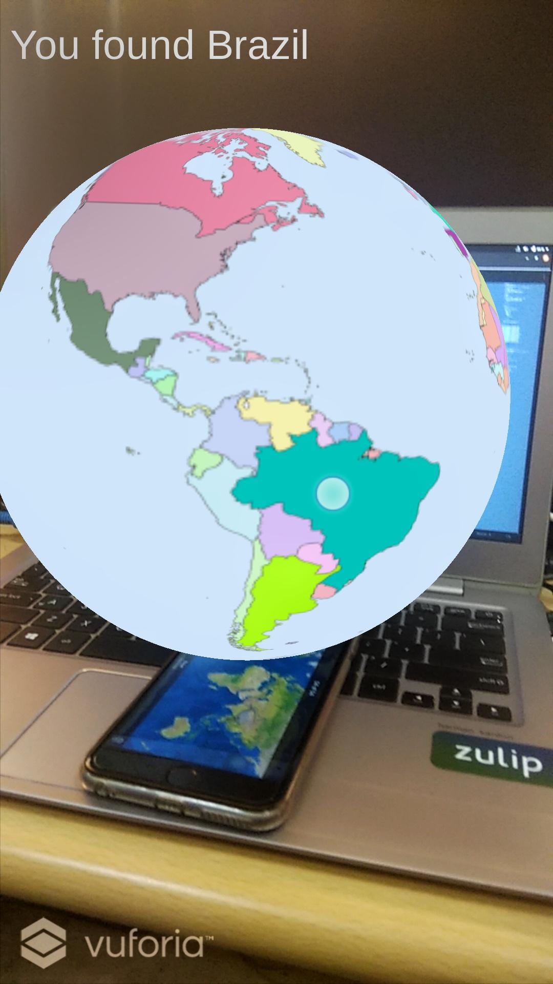
After some thought, we settled on using different colors on the map and then using those hex values to map different countries to each name.
But then we faced the issue of figuring out where the position we tap on the screen corresponds to on the sphere. And then also figure out which color that pixel we point to is. This was solved by looking into some codes on the Unity Answers Forum and a project made by a Google dev for one of their Chrome experiments.
After this we had to manually find a scalable vector image of the earth and then color each of the countries manually and write down their corresponding hex values. We even had to manually enter the values of the hashmap we made for mapping the RGB values to the country string name.
Luckily Unity is very good at exporting the same project onto iOS and Android so that part was fast. There were a few Android SDK path issues but that is bound to happen.
If we could find the latitudes and longitudes in an AR environment our project would've been much more appealing. We'll continue some further research trying to implement it.
Technologies used